
Islands Abridged: #NasaanAngCatanduanes
This program is a special edition of the Islands Abridged project as a response to #NasaanAngCatanduanes which arose as a response to the insufficient attention given to the island province front and center of the warpath of Typhoon Rolly.
It has always been the purpose of Islands Abridged to illustrate Philippine Geography in ways that make us aware of the distant and unfamiliar facets of our national identity and it is my hope that this helps in anchoring the news on real places we as Filipinos should know and care about.
+ + +
Long Story Short, it's an explorable, interactive map of the Philippines.
Want to see it in Filipino? It's here: https://martholemylabs.itch.io/pilipinas
I'd love to hear your thoughts about it! If you have the time, you can send those comments over through this comments form: https://forms.gle/gPR6DoZW96tbx39V6
And in case you want to help with my research, here's Islands Abridged Provincial Slumbook: https://forms.gle/TADvYSkfoZtuQ7BU7
Touchscreen Controls: Tap spaces or objects to move or select respectively, Tap twice to bring up and/or exit the Menu Screen.
Keyboard Controls: Use Directional Buttons to move around, "Z" confirms, and "X" Cancels.
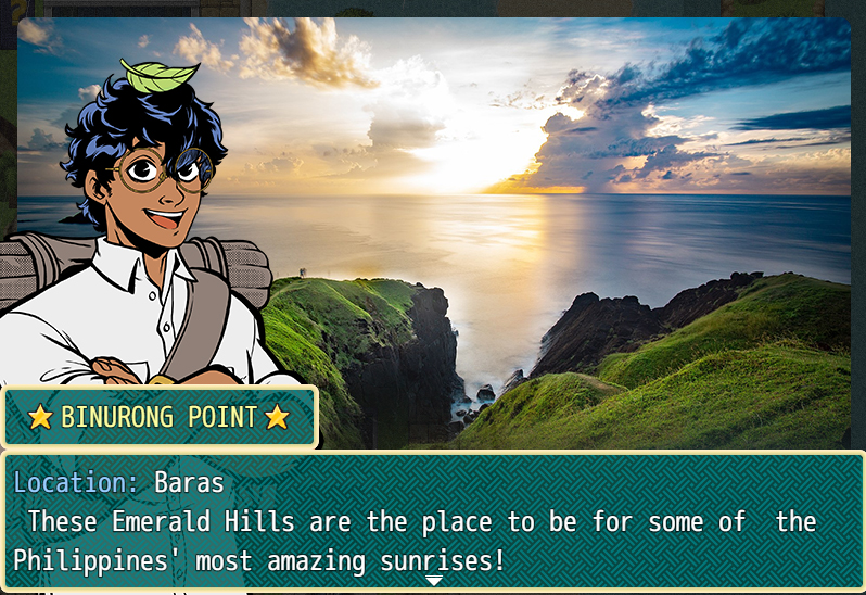
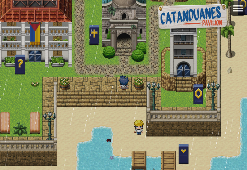
It's a fairly simple idea: what if the entire Philippines was plotted out like the map of a computer adventure game? The following is a Proof-of-Concept, meant to be updated and expanded on in stages and very much meant to evolve with community support. In it's current stage, it allows a fair amount of Guided Exploration Learning for people interested in getting into Philippine Geography. Subdivided into 100km2 tiles, the National Map includes all 300,000 square kilometers of Philippine Territory with markers for the capitals of the 81 provinces, plus a handful of independent cities, popular resort destinations, and natural wonders. The following provinces, while still largely under development, also currently have explorable Provincial Pavilions - areas designed to celebrate a province's people, history, and culture concisely: + Cavite + Catanduanes + Mountain Province +Biliran +Tawi-Tawi
I hope you have fun!
Islands Abridged is being written, designed, and developed by Marthy Arguelles Angue with the help of Dr. Kathleen Ann Modina-Angue and Cholo Salonga and with the support of Gunship Revolution and Roots&Wings Online Magazine .
Character illustrations was by Mclloyd Sumagpang and the Quiapo Free font is by Aaron Amar. Islands Abridged is designed on RPG Maker MZ with music from Kadokawa Inc.
Special thanks to free and paid plugins developed by VisuStella, Coelocanth, Moghunter, Caspergaming, and Galv. Special thanks for visual resources from Avy, Whtdragon, Hiddenone, Pandamaru, and the RPG Maker Community at large.


Leave a comment
Log in with itch.io to leave a comment.